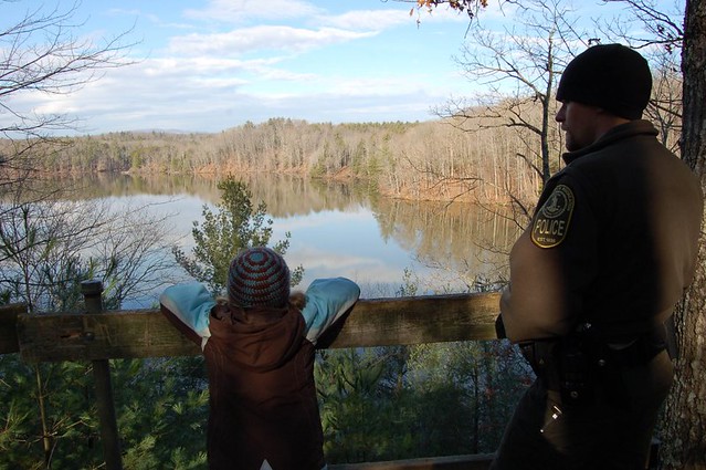
Overlook at Fairy Stone State Park

Close inspection when the leaves are off the trees show a few surprises
Participants will meet at 10:00 a.m. at the Stuart’s Knob Trailhead on Union Bridge Road (Virginia State Route 623) on the north side of Fairy Stone Lake (GPS 36.798504,-80.116784). This is open to the public without charge, we hope you will come out and join us!
The two-mile hike will begin with the Iron Mine Trail, which winds along high and steep ridges through areas of rhododendron and stands of beech, pine, hickory, poplar, maple, and sycamore trees. The trail’s namesake feature is the mouth of an old iron mine, its dark opening covered by a barred grate. Remnants of iron ore may be visible alongside the trail.
The path will then connect to the Upper and Lower Stuart’s Knob loops. After a few climbs and declines and a fine vista of a portion of Fairy Stone Lake, hikers will return to the parking area.
The park’s brochure rates the hike as strenuous, but Trip Coordinator Lucas Conkle, chair of DRBA’s Outings Task Force, considers the trails moderate. Switchbacks make it easier to climb the slopes, and Conkle plans to set a gentle pace to allow participants to enjoy the forest, the historic sites, and the views.
“The Stuart Knob Trail system has a nice mix of views and history,” Conkle says. “It is sure to become one of your favorite hikes if you go on the trip.”
Virginia’s first six state parks, is named for the cross-shaped staurolite, a rare mineral found in the region. Legend says this area was once home to fairies and other woodland creatures. Word of Jesus’ crucifixion so saddened these fairies that they wept tears which crystallized staurolite (silica, iron and aluminum) in the form of Maltese, Roman and St. Andrews crosses.
At the conclusion of the hike, participants will eat their picnic lunches near the shore of the 168-acre Fairy Stone Lake. The waters of the Smith River, delayed by the dam that forms the lake, eventually slip over the Fairy Stone spillway into Philpott Lake.
The 4,537 acre Stuart’s Knob on their own.
Participants are asked to bring lunch, water and a hiking stick; wear comfortable shoes or hiking boots; dress in layers of water-shedding artificial fabric or wool; and be prepared for rain or wind. All participants will be asked to sign a waiver form.
Directions: From US 220 at Bassett Forks, VA, turn west onto Hwy 57 (Fairystone Park Highway). Drive 12 ½ miles. Turn right onto Fairystone Lake Drive. Drive ½ mile, and turn left onto Fairystone Farm Lane. Continue onto Union Bridge Road. The destination will be 0.8 miles on the left.
From US 58 at Stuart, VA, turn north on Hwy 8. Drive 4 miles, then turn east onto Hwy 57 (Fairystone Park Highway). Drive 8 miles. Turn left onto Fairystone Lake Drive. Drive ½ mile, and turn left onto Fairystone Farm Lane. Continue onto Union Bridge Road. The destination will be 0.8 miles on the left.
Outings and meetings of the Dan River Basin Association are open to the public without charge, we invite you to join us!
For more information, contact Trip Coordinator Lucas Conkle at [email protected].
For membership information or more about DRBA, visit http://www.danriver.org/.
