When Norfolk and Southern abandoned the rail line in 1985 they donated the right way to the state, in 1986 it became a state park, New River Trail State Park.
One year later five miles of trail were opened, from Shot Tower to Austinville, now New River Trail is Virginia’s longest linear trail park. The history of the area can be seen and felt along the trail. Here are some things you may want to print this and keep it with you as you enjoy the trail.
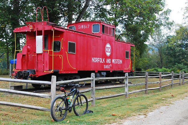
Rails to Trails parks are great for biking, hiking and horseback riding
Colorful Hiwassee:
Three iron oxide ores were mined from the area by Hoover Color Corporation. These natural ores can be made into over 300 different shades of pigments. Hoover Color now gets the different pigments from all over the world and mixes them together to make the different shades and ships them all over the United States. Hoover Color no longer mines the ore from the nearby mines. The color that Hoover is most famous for producing is UPS brown. They also make the many colors of Crayola Crayons.
Town of Allisonia:
The town was named for the Allison family who were early pioneers to the area. Established in 1872, Allisonia once housed the headquarters of 5 different mining companies in the iron industry. The old Baptist Church was built in 1891. Along the riverside of the trail, you will notice the Allisonia Depot and the old foreman’s house.
Milepost 14.1: Ore Washer:
The low stone wall halfway up the bank is all that remains of an ore washer. The ore washer was used to separate the metal form ore, which had already been crushed to a fine powder. Water was mixed in the powder creating metallic mud. The metallic mud was then agitated and allowed to settle. The metal rich properties would settle to the bottom while the waste would settle in layers above it. The top layers were raked away revealing the metal ready for smelting.
Milepost 19.6: Bertha Cave:
The process of erosion formed this cave. Water percolating in the ground has dissolved the surrounding limestone rock, carving a 100 ft deep t-shaped cave. A colony of bats live in Bertha Cave, as well as cave scuds, cave salamanders, cave crickets, and spiders. A bat gate has been placed in order to help in the conservation of the cave and all its inhabitants. It is designed to let the critters in and out the most harmful thing to a cave system “People”.
Somonas House:
The house with distinct bay windows sits a mere 10 feet from the trail. This house was built in 1873 prior to the railroad gaining the right of way through the area. Jim and Georgia Somonas had built the house; Jim ran a local blacksmith shop and Georgia was a school teacher. Typically, the railroad right of way was 40 feet to each side from the center-line of the trail path. An exception occurred with the Somonas house. The property line actually cuts into the railroad right of way just enough to cover where the house stands.
Foster Falls Furnace:
In the 19th century, dozens of iron furnaces and forges dotted the New River Valley, due to its high mineral content. The town of Foster Falls was a product of this iron industry.
The furnace built by the Foster Falls Mining and Manufacturing Co. in 1880-1881, was originally operated by water power from the New River. In 1889, the furnace was sold to the Virginia Iron Coal and Coke Co. The V.I.C increased the capacity of the furnace by eliminating the water powered bellows, replacing it with steam operated boilers a process known then as hot blasting.
In 1887, the railroad built a dinky rail bridge across the river to the hematite ore mines, 1/4 mile above the Foster Falls station. The furnace produced 12 tons of pig iron per day. The iron was transported to manufacturing centers in St. Louis, Baltimore and Cincinnati. In 1916, the rail bridge was washed out due to flooding, ceasing iron operations.
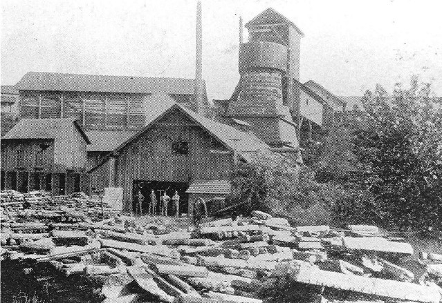
Foster Falls Furnace in the late 1800s
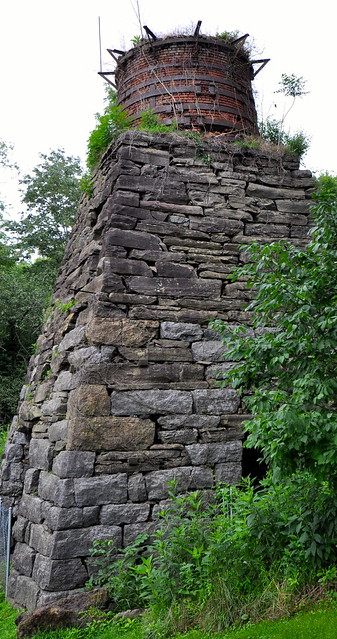
In the late 1800s the Furnace was the pillar of industry
Foster Falls Hotel:
The park is now in the process of restoring this historic structure. Although it stands empty now; the past still lives within its walls. The Foster Falls Hotel once was the center piece to a small, thriving mining community.
In 1887, the Foster Falls Mining and Manufacturing Co. were responsible for the construction of this historic structure. The hotel served as a meeting hall, post office, commissary and boarding house for employees of the mining industry. In 1889, the mining operation was sold to the Virginia Iron Coal and Coke Co. although the operations had changed hands; the hotel remained as a center piece.
In 1919, when the VIC left operations at Foster Falls, the hotel was sold for one dollar to the Abingdon Presbytery and converted to a girl’s industrial school. Industrial schools taught young ladies the art of home making, they were also given time for school subjects and bible studies. In 1938, a two story brick boy’s cottage was built beside the original structure and became a coed orphanage.
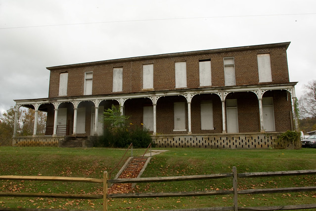
The old hotel at Foster Falls
Jackson’s Ferry:
The ferry used to run nearly the same path as the Jackson’s Ferry Bridge. It was one of the first ferries to run across the river in this region sometime prior to 1770. Several owners claimed the ferry route, and the route was the center of a legal dispute until 1885, when the route was awarded to Thomas Jackson. The Ferry ran until 1931 when the bridge was built. (Just past Mark E. Hufeisen Horse Arena)
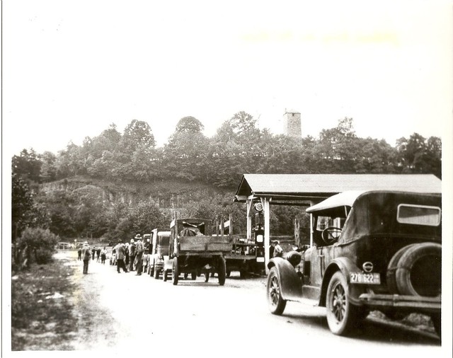
Being one of the first to run the river made the ferry very popular
Shot Tower Historical State Park:
For over 30 years the Jackson Ferry Shot Tower manufactured ammunition for a growing nation. It remains as a token of an era long gone, standing as a symbol of America’s industrial sovereignty.
English Immigrant Thomas Jackson came to the United States through Baltimore, to answer a call from Moses Austin who was hiring experts in the vocation of mining and lead works. Jackson was an industrialist and experienced miner who brought with him the trade secret of “drop shot”, a process that was refined by craftsman William Watts of Bristol, England.
The Shot Tower took over five years to build and was completed in 1807. According to research and tax records it was the first factory to mass-produce shot on American soil. The type of ammunition that was produced here was for shotguns, particularly “fowling shot”, for the local communities.
Manufacturing at the tower ceased in 1839 thus ending it’s grandeur as a producer of fine shot.
The tower stands seventy five feet tall with a shaft in the center that goes to the depth of seventy five feet which made the total drop 150 feet—the necessary height to form a perfect round ball. At the base of the river was an access tunnel that would allow workers to retrieve shot from the bottom of the shaft. Norfolk and Western Rail Road Co. collapsed the tunnel when they brought the rail line through to prevent a potential catastrophe.
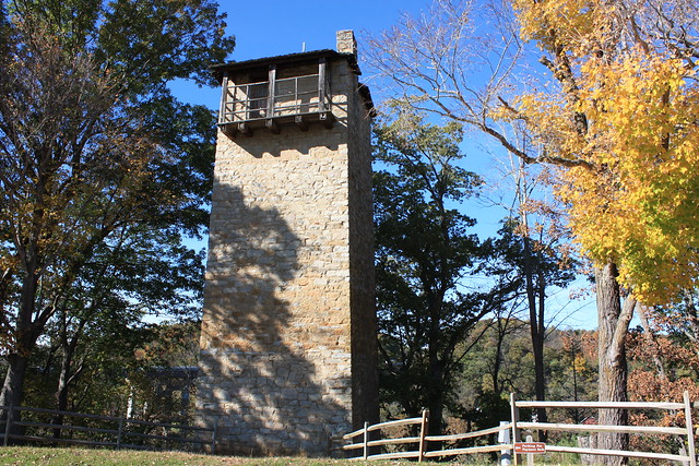
Shot Tower State Park
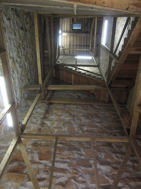
Get a look at the inside of the tower during an interpretive program
Drop Shot Process:
Workers would hoist the lead to the top of the tower by means of block and tackle which used livestock, ropes and a system of pulleys. Lead was smelted and arsenic added, making it more pliable and easier to pour into the giant sizing sieves. Sizing sieves were like big pasta strainers with different sized holes in the sieves. Using multiple sieves gave them the advantage of making more than one size of shot. Once the molten lead was poured into the sieve, it free fell through the tower into a kettle of water at the bottom. Water did not cool the shot; however, it acted as a cushion to prevent deforming the shot. The shot was then retrieved, dried, and polished with graphite to be sold on site or shipped down river to nearby towns.
Tale, Tale:
Just through the other side of Austinville tunnel yellow chains hang now, during the days of the Railroad these would not have been chains. Instead they were long slender leather pieces around 2 feet in length. These pieces hung there as a warning system to any person(s) having to work a top the rail cars while in motion. If they got touched on the back, or brushed in the face this was a tale, tale sign of the train approaching a tunnel.
Mine Vent Shaft:
Vent shafts are used to allow air to flow through the deep mine shafts. A number of vent shafts would be built to allow fresh air to circulate. Some vent shafts would draw air, while others would expel air. Vent shafts are fairly common, and pose a serious hazard to the average passerby. They can extend laterally 100’s of feet and then suddenly drop off to the lowest depths of the mine.
Austinville Lead Mines:
Col. John Chiswell discovered lead in this area in 1756. The Austinville Lead Mines were the driving force behind the region’s economy for over two centuries. The company produced only lead from 1756 to 1874. In 1874, zinc became a viable resource. This mine provided most of the lead for the Revolutionary War, helping ensure victory for the colonies against the rule of Great Britain. Eighty-five years later, the mines provided lead for the Confederacy’s war effort during the Civil War. The Austinville Lead Mines operated for over 200 continuous years, making them one of the oldest mining operations in North America when they closed in 1981. Also the Fincastle Resolutions were written and signed right here at this location, refer to internet for information to Fincastle Resolutions.
Ivanhoe:
Ivanhoe like other small towns that dotted the New River were centered on mining and quarrying industries. Area mines produced limestone, low grade iron ores and carbide. Ivanhoe at one time boasted an opera house, several hotels and an iron furnace company. Speculators and entrepreneurs alike moved here seeking opportunities and fortunes. Even though the mining industries have since gone, descendants of Ivanhoe’s early settlers still call the area home.
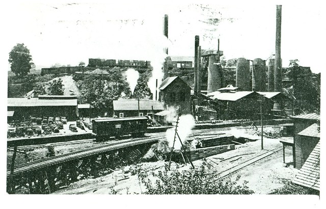
Ivanhoe furnace provided jobs in the region
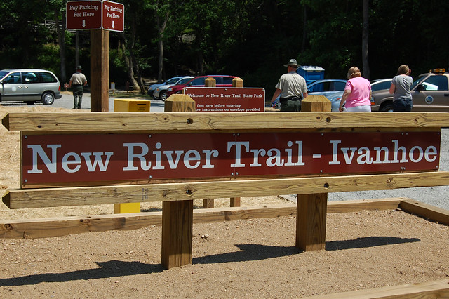
Ivanhoe is an access to the trail that can accommodate horse or bike trailers
The Power of the River:
Byllesby and Buck Dam harnessed the power of the New River and converted it into electricity. 4000 workers built the dams in the early 1900’s. 1000 of them were Italian immigrants from Boston who leant their dam building expertise. Appalachian Power ran the two dams whose employees lived in communities provided by the company and houses at Buck Dam and 12 houses at Byllesby. The communities shared a school, store and baseball field. The communities were later abandoned when automation took over the day to day operation of the dams.
One employee’s home at Byllesby is all that remains of the shared community.
Grayson Sulphur Springs:
For centuries people have “taken the waters” of naturally heated sulphur springs to aid in a variety of ailments including digestive, pulmonary diseases and skin disorders. It was thought that something that tasted and smelled so bad had to do some good. Analysis of sulphur waters are shown to contain: soda, magnesium carbonate, calcium carbonate, magnesium sulphate as well as other minerals and gases. There are many places around the world today where people can enjoy the therapeutic values of these waters.
In the late 1850’s, disaster struck the once thriving resort. Two days of steady rain caused the river to give way to flooding leaving the resort underwater. Natural disasters and approaching Civil War put an end to “good ole days” at the Grayson Sulphur Springs.
In the early 1890’s Dr. J.L. Kernoodle and his brother Dr. George Kernoodle, built the new two stories, 32 room hotel seen above. It’s not known whether the old buildings were demolished or lost their battle with elements and time. The new hotel was open from May to “huckleberry time”, guests arrived mainly by the newly built rail line until 1902 when a good road was built from Ivanhoe to the springs. The new resort was quite successful, and not only with locals. Guests came from New York, Florida and as far away as Texas.
The new resort lasted only a short time. In 1913, the property was sold to New River Power Co., the predecessor of Appalachian Power. When they constructed the hydroelectric dam at Byllsby, the Grayson Sulphur Springs area was inundated. The River Inn was razed before water closed over it; some say that the old spring house can be seen in the lake during low and clear water conditions.
Gambetta Tunnel:
This 195ft tunnel is carved right through the cliff side. This is one of the two tunnels on the trail the other we went through at Austinville. The tunnels were dug out without the use of explosives, and the rough cut edges illustrate the grueling man labor involved in the task.
Chestnut Creek Falls:
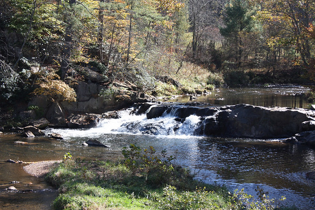
Take a moment to photograph the falls.
