The rehabilitation work on High Bridge at High Bridge Trail State Park continues to progress.
R.L. Farris, a steel installation contractor from Forest, Virginia is on site and installing the steel for the three overlooks that are part of the project. The overlooks will provide areas for visitors to the bridge to stop and enjoy the panoramic views that are offered from the bridge. The overlooks will also be areas where people can reflect on the history of the bridge and the area through interpretive signs and programs.

Construction workers from R. L. Farris will install three steel overlooks on the bridge
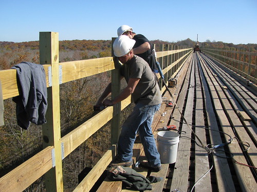
Keith Barber Construction from Farmville Virginia is the General Contractor for the project. Keith Barber’s crews have completed a majority of the work and are currently installing the handrail system. The project, which is now 8 months in production, is starting to take shape. “It is exciting to start to see what the final product will look like” said park manager Eric Hougland. “Now that the steel is being put in place and the handrails are going up I realize that we are getting closer to the finish line.”

Construction crews from Keith Barber Construction are installing a handrail system
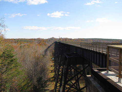
High Bridge Trail State Park is a 31 mile long rail to trail conversion and is Virginia’s newest state park. Currently, 28 miles of the multi-use trail are open and available for hiking, bicycling and horseback riding. The park is ideally suited for people of all ages and ability levels because the surface is firm, wide, level and has very little grade. High Bridge stretches over 2400 feet long and rises 160 feet above the Appomattox River. The bridge is the park’s namesake and is the iconic feature of the park. Construction work on the bridge is scheduled to be complete in early 2012.

Construction work on the bridge is scheduled to be complete in early 2012
To learn more about High Bridge and High Bridge Trail State Park, click here.
High Bridge Trail is about 31 miles long and runs through Cumberland, Nottoway and Prince Edward counties and the towns of Burkeville, Farmville, Pamplin City, Prospect and Rice.
Entrances – Parking availability:
Rice's Depot Road, 1/4-mile off U.S. 460 at Rice, near trail milepost 142
River Road, three miles off N. Main St. in Farmville, near trail milepost 146
Osborne Road, 1/4-mile off N. Main St. in Farmville, near trail milepost 149
Municipal lots in Farmville where the trail intersects with Main St. near trail milepost 150
Tuggle Road, off U.S. 460 and near U.S. 15 North, near trail milepost 156
Prospect Road, off U.S. 460 at Prospect, near trail milepost 161
Elam, off U.S. 460 at Sulpher Spring Rd., near trail milepost 164
Heights School Rd., of U.S. Business 460 near Pamplin, near trail milepost 168
Latitude, 37.304488. Longitude, -78.390938.
